rurtech.ai

Applied AI for land, soil and water

Intelligence for the real world.

rurtech.ai builds AI that reads satellites, soil records, photos and voice, then turns them into decisions people can act on. Agriculture is our first platform. Soil health and ending blanket urea are our first priority.

NVIDIA Inception Program member badgeMember of the NVIDIA Inception programme since 23 April 2026.
The rurtech.ai robot in green, with AI Bhoomi showing in its visor

Behind the robot: live 3D globe. Satellite imagery © Esri, Maxar, Earthstar Geographics. Glowing points: places with five or more AI Bhoomi farmers.

13,693farmers on AI Bhoomi
76,802messages with farmers
33states with farmers
367districts with five or more farmers

Enter the world of rurtech.ai

AI and machine learning for every industry that needs space data.

Satellites see land, water, crops, buildings and ships every few days. We build the models that turn those pictures into answers. Agriculture is where we started. The same engine works wherever a decision depends on what is happening on the ground.

  • Real Sentinel-2 crop vigour map of farmland around Nandi Hills, Karnataka
    Live

    Agriculture

    Our first platform. Soil, crop and fertiliser advice for farmers on WhatsApp, and field tools on RurSat.

  • Screen of the rurtech.ai Live Flight Tracker showing aircraft over north India
    Testing, free

    Aerospace and aviation

    Live aircraft positions from ADS-B on satellite imagery, and orbit and pass prediction for mission planning.

  • Real Sentinel-2 image of farm parcels near Nandi Hills, Karnataka, 8 December 2025
    On request

    Banks and rural credit

    Parcel-level evidence of crops, soil moisture and land use over time, to support lending decisions.

  • Real crop vigour map of the same farm parcels near Nandi Hills, Karnataka
    On request

    Insurance

    Crop condition by date for a drawn parcel, with flood and fire layers, to support underwriting and claims review.

  • Real Sentinel-2 image of villages and fields near Muzaffarnagar, Uttar Pradesh, from RurSat Explorer
    On request

    Construction and infrastructure

    A decade of archived imagery to track construction, audit encroachment and check how land has changed.

  • Real Sentinel-1 radar overlay of a field block near Muzaffarnagar, Uttar Pradesh
    In development

    Disaster and government

    Flood and hazard mapping from Sentinel-1 radar, which sees through cloud, with live fire detections and village search.

  • Screen of Bhujal Intelligence, the rurtech.ai groundwater tool, showing a map of India
    Testing, free

    Water

    Groundwater prospects and quality, depth to water and pond volumes.

  • Screen of RurSat Globe showing an AI weather forecast of temperature and wind on a 3D globe
    Testing, free

    Climate and weather

    AI weather on a 3D globe, carbon dioxide and methane plumes from NASA EMIT, and daily global satellite views.

  • Real Sentinel-2 true colour image of hills and farmland around Nandi Hills, Karnataka
    Testing, free

    Forestry and maritime

    Plantation site checks and canopy views over any drawn area, and vessel detection from Sentinel-1 radar.

Every picture is a screen of our own tool, or a Sentinel-1 or Sentinel-2 image.

Our first priority · powered by rurtech.ai

All things soil live on RurSat. Urea by need, not by the bag.

A flat urea dose treats a whole field the same, and no field is the same. RurSat reads the soil, maps the field and sends a dose for each patch.

  1. 01

    Read the soil Live

    A lab value always comes first. 12.6 million government soil lab tests are indexed across 33 states. Where no test exists, the 12-parameter soil card is marked as an estimate.

  2. 02

    Map the field Live

    Satellite zones inside the real field boundary, so weak and strong patches are seen apart.

  3. 03

    Send the dose Live

    Urea, DAP and MOP for each zone on WhatsApp, in Hindi, with when to apply.

  4. 04

    Measure the saving Pilot

    The zone map moves urea from strong patches to weak ones. Half-zone, half-flat strips with crop cuts measure what can be cut.

Fields 200 m apart. pH 5.5 in one, 7.95 in the other.Government lab tests, Bijjawara, Karnataka. This is why every farm needs its own soil record.
89 of 91 fertiliser sales were at or below the 95 kg N/ha dose.One retailer’s sale register, Uttar Pradesh, Kharif 2026. Median 27.6 kg N/ha a visit. Farmers here buy little at a time and unbalanced, so the advice is the right dose and the right mix.
Real NASA EMIT map of surface iron minerals over the same 14 km block Real NASA EMIT map of surface clay minerals over the same 14 km block

Surface iron (left) and clay (right) from NASA EMIT, over the same block.

A RurSat Soil Health CardTwelve parameters and the field from satellite, in Hindi and English. Card from 28 Oct 2026, Uttar Pradesh.
Satellite image of the field with its boundary marked in yellow
Soil Health Card section showing twelve soil parameters with their values, ranges and source labels
Soil laboratory network

RurSat Spectral Research Labs Pvt. Ltd. has been a member of the Global Soil Laboratory Network (GLOSOLAN) since 22 October 2026.

GLOSOLAN runs under the Global Soil Partnership of the Food and Agriculture Organization of the United Nations and works to harmonise soil laboratory measurements.

The AI underneath

Many models. One answer people can act on.

Every answer is grounded on field data, not free text. Where a lab value exists, the lab value wins.

  1. Reads

    What comes in

    • Location pin
    • Crop photo
    • Voice note
    • Soil lab report
    • Satellite passes
  2. Understands

    Models at work

    • Language models with tools
    • Computer vision
    • Speech in and out
    • Spectral and time-series models
    NVIDIA Inception Program member badge
  3. Checks

    Grounded on

    • Government soil lab records
    • Land records
    • Weather forecasts
    • Agronomy rules, shown with the output
  4. Answers

    What goes out

    • Fertiliser zone map
    • Dose card
    • Soil card
    • Reply in the farmer’s language
NVIDIA Inception Program member badge

NVIDIA in our stack

Member of NVIDIA Inception since 23 April 2026. Inception Capital Connect access approved 24 April 2026. The models run under our own NVIDIA NGC enterprise organisation, RurTech For Arayans LLP.

Animated FourCastNet forecast of temperature and wind over India
Our own FourCastNet run on an RTX 5060: 120 hours over India from ERA5 data, started 20 Apr 2026.
  • Nemotron language models

    Live

    Served through NVIDIA NIM. They reason through a farmer’s question and decide which tools to call.

  • Earth-2 FourCastNet

    Live

    AI weather forecasts feed our crop and pest pipeline through a public forecast service. We have also run the model ourselves: 120 hours over India in 14 seconds on one RTX GPU.

  • NIM embeddings and reranking

    Live

    Find the right passage in our agronomy knowledge before an answer is written.

  • Cosmos and NIM vision

    Live

    Read field video frame by frame for pest checks.

  • Magpie and Riva speech

    Live

    Text to speech in Hindi and English.

  • CUDA

    Training

    Soil and groundwater models are trained on NVIDIA GPUs with PyTorch and CUDA.

  • RAPIDS: cuSpatial, CuPy, cuCIM

    On demand

    Speed up heavy imagery and map jobs on a GPU worker we start when the work needs it.

  • Field Twin

    Testing

    Wind, spray drift and runoff on a field, modelled on NVIDIA’s digital-twin blueprint for fluid simulation. Our own solver, running in the browser.

  • Agents with tools

    Plan, call tools and answer from field data.

  • Speech

    Whisper and other speech models: voice notes in and voice replies out, in Hindi and other Indian languages.

  • Computer vision

    YOLO detection and SAM segmentation: pest photos, animal detection, field boundaries and vehicle handover checks.

  • Hyperspectral soil analysis

    Surface soil minerals from NASA EMIT, and lab-spectra screening models.

  • Satellite time series

    Crop vigour and moisture from Sentinel-1, Sentinel-2 and Landsat, with gradient-boosted models on top.

  • Document intelligence

    A soil lab PDF in, a Soil Health Card out.

Wayback · rurtech.ai/wayback

Every field, sharper than a metre, with the date it was taken.

Every version of the world's high-resolution satellite imagery since 2014. Show only the versions where a place changed, swipe between two dates or play them as an animation, and click the map for the day the picture was taken.

Screen of rurtech.ai Wayback: the twelve imagery versions with local changes for Baheri village, Khandwa, Madhya PradeshOpen Wayback
Opens at Baheri village, Harsud, Khandwa district, Madhya Pradesh. App and imagery: Esri World Imagery Wayback (open source, Apache-2.0).Also at wayback.rurtech.ai

In the news

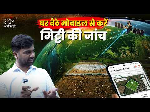
Seen on Gaon Connection.

The rural media platform on what AI can do for soil and crops, with our founder on camera.

  • AI बताएगा मिट्टी की सेहत, खड़ी फसल की पैदावार, लगने वाले रोग

    AI will reveal soil health, crop yield and likely diseases

    Gaon Connection TV · 15 Oct 2026 · 10:53
  • दुनिया में कहीं भी पा सकेंगे खेत की मिट्टी और फ़सल की जानकारी

    Get soil and crop information from anywhere in the world

    Gaon Connection TV · 17 Sep 2026 · 5:01
  • खेत में खड़ी फसल का उत्पादन, कहां मिलेगा अच्छा भाव? AI से खेती हुई कितनी आसान?

    Crop yield, the best price, and how AI makes farming easier

    Gaon Connection TV · 16 Oct 2026 · 1:11

Reports by Gaon Connection TV on YouTube.

Recognition

Recognised and selected.

Government
  • DPIIT recognised startup

    Certificate DIPP229625, issued 15 Nov 2025, valid to 20 Oct 2035. AI and machine learning.

  • Startup in UP

    Recognised 7 Feb 2026. Sustenance allowance first tranche approved 27 Jul 2026, one of 52 startups approved of 111 evaluated.

  • AIC-BIMTECH incubatee

    Incubated since 10 Feb 2026.

  • GeM

    Government e-Marketplace

    Registered seller since 19 Jul 2026.

Technology programmes
  • NVIDIA Inception

    Member since 23 Apr 2026. Inception Capital Connect access approved 24 Apr 2026. NGC enterprise organisation held by the LLP.

  • AWS Activate

    Member of the AWS startup programme, with cloud credits since Dec 2025.

  • Google Cloud for Startups

    Member of the cloud startup programme.

  • Google Maps Platform

    Google Maps Platform Innovators

    Community member since 30 Oct 2025.

Soil laboratory network · RurSat
  • GLOSOLAN

    Global Soil Laboratory Network

    RurSat Spectral Research Labs Pvt. Ltd., member since 22 Oct 2026, under the Global Soil Partnership of the Food and Agriculture Organization of the United Nations.

Selected and invited
  • MFOI Awards 2026: Agristartup Icon

    Krishi Jagran selected our founder for this award. Ceremony 1 to 3 Dec 2026, ICAR-IARI, Pusa, New Delhi.

  • Ministry of Agriculture

    AI Hackathon, stage 2

    Ministry of Agriculture and Farmers Welfare, 15 May 2026.

  • IIT Kharagpur

    National Climate Innovation Challenge 2026

    Shortlisted for the startup pitch session, 15 May 2026.

  • UP Deeptech Mission

    UP Deeptech Mission 2026

    Selected for the Noida chapter pitch, 26 Jun 2026.

  • UIDAI

    UIDAI Biochallenge

    Selected for the benchmarking competition, 23 Jan 2026.

  • National Space Technology Conclave

    National Space Technology Conclave

    Invited to showcase, referred by IN-SPACe, 9 Aug 2026.

Customer and partner
  • Aditya Birla Group

    UltraTech Cement

    First enterprise customer. Service order 14 Oct 2026. Contract details.

  • BMS AgriAllied

    BMS AgriAllied Ventures Pvt. Ltd.

    Commercial partner.

Open data we use
  • NASA

    NASA

    EMIT, GRACE-FO, POWER, Worldview.

  • ESA Copernicus

    ESA Copernicus

    Registered user of the Copernicus Data Space Ecosystem.

  • ISRO · CGWB

    ISRO Bhuvan and CGWB

    Land and groundwater data.

Certificates and letters are available on request: saddam.hussain@rurtechforarayans.com.

Evidence

What we have done, with the numbers.

First enterprise contract

UltraTech Cement, an Aditya Birla Group company

A one-year contract for satellite-based farm management in the programme villages around Vikram Cement Works, Neemuch, Madhya Pradesh.

Customer
UltraTech Cement Limited, Unit: Vikram Cement Works, Khor, Tehsil Jawad, Neemuch, MP 458470
Contracted with
RurTech For Arayans LLP
Order confirmed
29 Sep 2026
Service order
14 Oct 2026
Term
14 Oct 2026 to 13 Oct 2027
Area
Annual subscription for a mapped area of up to 1,000 acres
Platform
Mobile and web platform to map farms, monitor soil, crop and water conditions, send weather, irrigation, pest and disease advisories, and give UltraTech one central view
Support
Online orientation, a user guide in Hindi and English, and seven days of field support and farmer training
Mapping work
25,932 of 26,415 Neemuch land parcels mapped with owner records

Working today

  • Aditya Birla GroupFirst enterprise order: UltraTech Cement, Vikram Cement Works, 14 Oct 2026
  • 25,932 of 26,415Neemuch land parcels mapped with owner records
  • Live farmer feedPublic, anonymised, updated every minute

Measured

  • 784 government lab testsCompared with satellite soil signals in one 14 km block
  • 16 NASA EMIT passesOver the same block, with methods shown
  • Every figure has its sample sizeRead the evidence

From the field

  • 256 fertiliser salesA retailer’s sale register, Uttar Pradesh, 21 Apr to 22 Jul 2026: 472 urea bags and 83 DAP bags
  • 87% of visitsBought two urea bags or fewer
  • Rs 1,395 a hectareLess for the farmer at the soil-based paddy dose of 95:40:35 than at the blanket 120:60:60, at register prices

Company

Built in India, from the field up.

RurTech logo

Saddam Hussain

Founder, CEO and CTO

More than ten years in industrial audits, compliance frameworks and quality management, where he saw how often big decisions rest on late, costly or unreliable data.

He grew up in a farming family in rural India and started RurTech in late 2025, without institutional capital, to close the gap between the data that exists and the people who need it.